| Sign In | Join Free | My ecer.jp |
|
| Sign In | Join Free | My ecer.jp |
|
| Categories | LiDAR Scanning System |
|---|---|
| Brand Name: | Geosun |
| Model Number: | GS-130X |
| Certification: | CE,ISO |
| Place of Origin: | China |
| MOQ: | 1 |
| Price: | Negotiation |
| Payment Terms: | T/T |
| Delivery Time: | 10-15 works days |
| Packaging Details: | Suit Case 450*365*200 mm |
| Company Info. |
| Wuhan Geosun Navigation Technology Co., Ltd. |
| Verified Supplier |
| View Contact Details |
| Product List |
LiDAR Scanning System GS-100V HESAI XT16 Laser Sensor Built-In Camera High Precision Aerial Scan
Geosun gAirHawk LiDAR Scanning System GS-100V
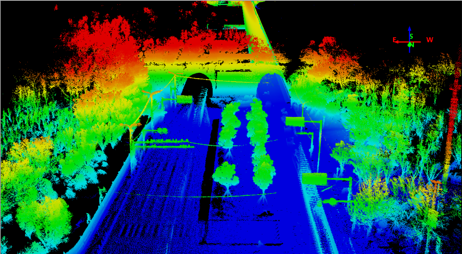
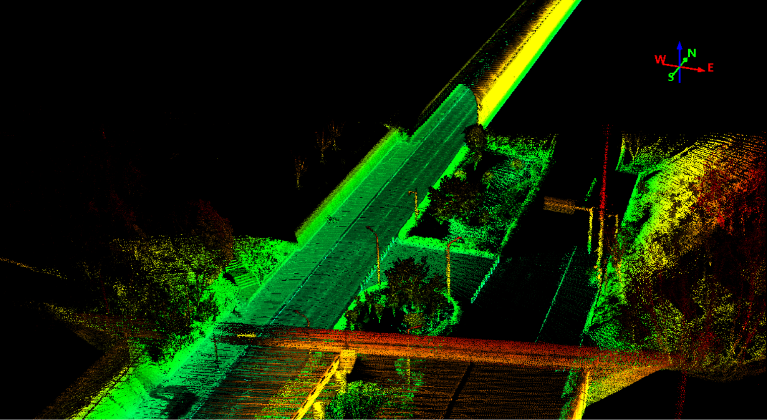
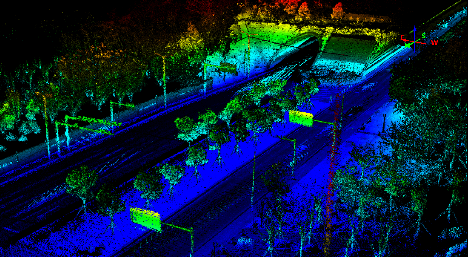
gAirHawk GS-100V is a kind of short-range, compact LiDAR point cloud data acquisition system, integrated HESAI XT16 laser scanner, GNSS and IMU positioning and attitude determination system, and storage control unit, is able to real-time, dynamically, massively collect high-precision point cloud data and rich image information. It is widely used in the acquisition of 3D spatial information in surveying, electricity, forestry, agriculture, land planning.
Specification of LiDAR Scanning System gAirHawk GS-100V
| |||||||||||||||||||||||||||||||||||||||||||||||||||||||||||||||
Application of LiDAR Scanning System gAirHawk GS-100V
Free Trial Software UAV LiDAR Scanning System gAirHawk GS-100V
Free trial test, achieve high precision
The Guideline of LiDAR Usage and Reference.pdf
Point Cloud Pre-Processing Software Integrated With Trajectory
Processing----Geosun Self-developed gAirHawk 5.0
Key Features of gAirHawk 5.0 Software
1. Raw data: intelligently load
2. Four default coordinates
3. Point cloud Optimization
4. Start and stop calculation


Package of LiDAR Scanning System gAirHawk GS-100V
LiDAR Scanning System gAirHawk GS-100V packed by suit case with EVA material liner inside, then covered by hard carton box. It is suitable for air shipment and sea shipment.


|
